Highland Historic Environment Records (interactive map)
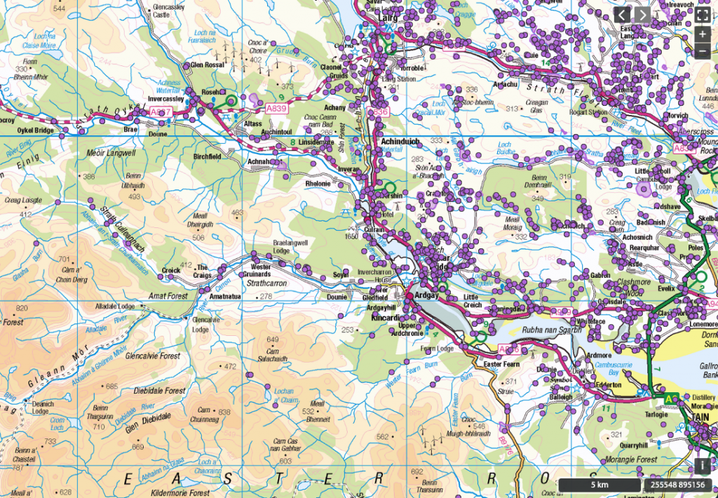
Archaeological sites of interest
- The Kincardine Stone (and 3-page description)
- The Migdale Hoard
- Tumulus on Edderton Glebe
- Standing Stone, Stone Circle, and Pictish Stone; also see Historic Environment Scotland, Canmore Scotland, and Megalithic portal
About Ptolemy (c. 150) and Càrn Smeart
The Smertae were a people of ancient Britain known from a single mention by the geographer Ptolemy, c. 150. From his general description as well as the approximate locations of their nearest neighbours, the Decantae and Lugi tribes, their territory was in the modern area of central Ross and Sutherland. While the etymology of Smertae is not known for certain, it could mean “providers” or “far-sighted ones.”
Their name is commemorated by Càrn Smeart, an ancient burial mound on the ridge between the rivers Carron and Oykel, a burial cairn discovered by Dr Watson.
The Smertae (one of the ancient tribal names recorded by Ptolemy and others) lived in the basin of the Oykel and probably also in the adjoining basin of the Carron to the south of it [and their] name, as discovered many years ago, is still extant in Carn Smeart, the name of a hill on the N side of Strathcarron, in the ridge between it and Strathoykel.
Watson, W J. (1926) The history of the Celtic place-names of Scotland: being the Rhind lectures on archaeology (expanded) delivered in 1916. Edinburgh.
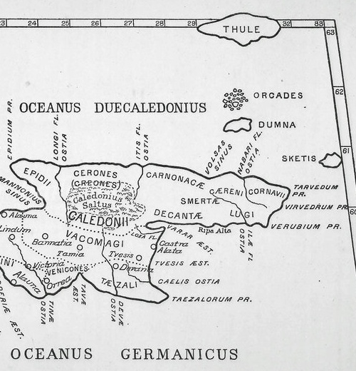
Ptolemy’s map (c. 150 AD) and approx. location of tribes mentioned by Ptolemy:
From Ptolemy’s map, we can see the following: “In the Kyle of Sutherland area the map shows three tribes of Picts. On the coast to the south of the Dornoch Firth are the Decantae, on the coast north of the Firth are the Logi, with the Firth clearly being shown as dividing these two peoples. Further inland in the Strath Kyle / Strath Oykel area Ptolemy places a third tribe called Smertae who are clearly shown to straddle the inland portion of the Kyle of Sutherland…” – The Kyle of Sutherland: a brief history (Copley, 2015)
For records from Historic Environment Scotland, see here and here.
Claudius Ptolemy, a 2nd century Roman geographer, was one of the first scientific map makers. His Map of Britain is available here. Notably, while his outlines of England and Ireland are accurate on his map, he has placed Scotland at a right angle, showing as west to east instead of south to north. Ptolemy noted 10 tribes situated north of the River Forth, these tribes being independent of the Roman province of Britannia.
More information about Ptolemy’s Map of Scotland:
- Explaining Ptolemy’s Roman Britain (Strang, 1997)
- Marinus, Ptolemy and the Turning of Scotland (Jones & Keillar, 1996)
- Ptolemy’s Map of Scotland (Tierney, 1959)
- The history of the Celtic place-names of Scotland (Watson, 1926)
Smertae tribe & the Fort & Dun, Langwell
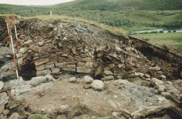
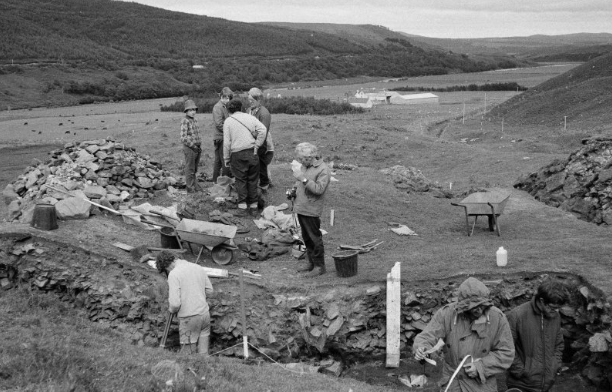
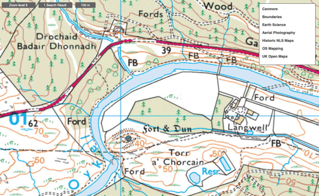
Smertae is the tribal name referred to in the Geography of Ptolemy, based on a topographical place-name somewhat of the form Smerdion. It is assumed that at one time, the whole region from Inverness up to the north coast of Sutherland and Caithness was inhabited by this tribal people. One particular location in the Kyle is associated with the name, Langwell hillfort, a little to the east of Oykel Bridge in the Oykel valley. For more information, see here.
“since Ptolemy describes the Smertae as being above the Lugi … this indicates that the Smertae lived inland, not on the coast. So the place with a name somewhat of the form Smertion, or more probably Smerdion, will have had an inland location… The most obvious candidate would be the hillfort at Langwell (NC 410 009), a little to the east of Oykel Bridge in Sutherland. The defences of the fort are said to comprise three circuits and it is thought that these circuits may have been built at different times. This may indicate that the fort was occupied by three different groups… [One of these] presumably used the fort at Langwell as their tribal centre, the tribe then being known as the people of Smerdion… this later changing to Smertae.” (source)
Canmore description of Langwell, Tor A’ Chorcain (with many photos)
Highland Historic Environment Record for MHG7371, Fort & Dun, Langwell
For more information
Highland Historic Environment Records


